Cambrian Way South
Devil's Bridge to Conwy
Format:Sheet map, folded
Publisher:Harvey Map Services Ltd
Published:11th Apr '25
Should be back in stock very soon
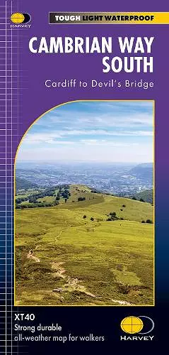
The Cambrian Way is a challenging mountain trail that runs from Cardiff Castle in South Wales to Conwy Castle in North Wales.
The entire route is 479km (298 miles) long and has nearly 24,000 metres of elevation - the route goes over many of Wales' major mountains and takes in some of the country's finest scenery, traversing both Bannau Brycheiniog (Brecon Beacons) and Eryri (Snowdonia) National Parks.
The route takes approximately 3 weeks to walk and is covered on 2 separate waterproof maps - Cambrian Way South (Cardiff to Devil's Bridge) and Cambrian Way North (Devil's bridge to Conwy).
As this is often a remote route, a map and compass are essential for the long, un-waymarked stretches of exposed and unspoiled wilderness. If you like peace and quiet then this is the walk for you!
The entire route across two maps; including sections through Bannau Brycheiniog
National Park, the Cambrian Mountains and Eryri National Park
A good week's walking on each map
Information on accommodation and services
Lightweight, detailed, clear and easy to read. The route is clearly highlighted in red
Printed on tough 100% waterproof, tearproof paper
Full map legend in English and Welsh
ISBN: 9781851376889
Dimensions: unknown
Weight: unknown