Ben Alder
Format:Sheet map, folded
Publisher:Harvey Map Services Ltd
Published:9th Mar '23
Should be back in stock very soon
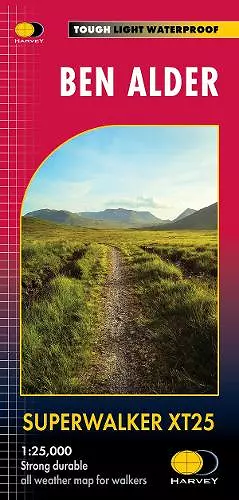
Includes Creag Meaghaidh and Corrour Station. Detailed map for hillwalkers at the popular 1:25,000 scale of the area around Ben Alder west of Dalwhinnie and the A9. Includes 24 Munros, 4 Corbetts and 3 Grahams. Tough, light, durable and 100% waterproof Genuine, original, HARVEY mapping Opens directly to either side of the sheet Easy to re-fold 1392 x 486mm flat
ISBN: 9781851376599
Dimensions: unknown
Weight: 62g