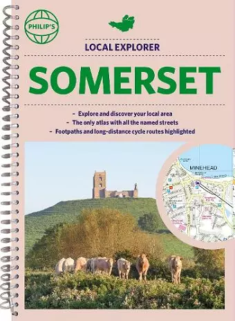
Philip's Local Explorer Street Atlas Somerset
(Spiral binding)
Format:Spiral bound
Publisher:Octopus Publishing Group
Published:4th Aug '22
Should be back in stock very soon

This atlas offers detailed maps for walkers, cyclists, and local explorers in Somerset, highlighting scenic routes, parks, and points of interest, while ensuring easy navigation through roads and pathways.
Philip's Local Explorer Street Atlas Somerset is a comprehensive guide designed for walkers, cyclists, and local adventurers eager to explore the natural beauty and hidden treasures of Somerset. This atlas offers detailed mapping at a scale that emphasizes greener routes, allowing users to discover the area's parks, historic sites, and nature spots while avoiding busy main roads. From Bath to Yatton, the atlas covers the entirety of Somerset, providing a rich resource for those looking to appreciate the surroundings right at their doorstep.
The detailed scale of the atlas enables users to select pathways, bridleways, and lanes that enhance their outdoor experiences. Whether wandering through local parks or exploring charming neighborhoods, the atlas includes clear maps and essential information to ensure a rewarding journey. For those who need to travel to reach their desired destinations, the atlas features A and B roads prominently on its Route Planner, along with large-scale town and city plans for easy navigation.
Uniquely, this atlas names every road, street, and lane in Somerset, highlighting the best pedestrian and long-distance cycling routes. It also points out various points of interest, including camping sites, golf courses, and leisure centers. With additional details on one-way streets, car parks, public transport stations, and essential services, Philip's Local Explorer Street Atlas Somerset serves as an indispensable tool for anyone looking to explore this beautiful county in depth.
ISBN: 9781849076036
Dimensions: 266mm x 194mm x 18mm
Weight: 600g
288 pages