A Middlesex 1611 – 1836 – Fold Up Map that features a collection of Four Historic Maps, John Speed’s County Map 1611, Johan Blaeu’s County Map of 1648, Thomas Moules County Map of 1836 and a Map of the Environs of London 1836.
Mapseeker Publishing Ltd author
Format:Paperback
Publisher:Historical Images Ltd
Published:4th Jan '19
Should be back in stock very soon
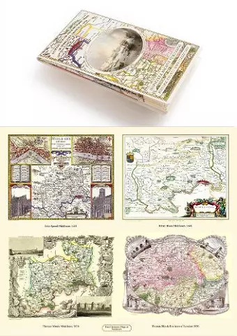
This non-fiction paperback, "A Middlesex 1611 – 1836 – Fold Up Map that features a collection of Four Historic Maps, John Speed’s County Map 1611, Johan Blaeu’s County Map of 1648, Thomas Moules County Map of 1836 and a Map of the Environs of London 1836." from Mapseeker Publishing Ltd, was published 4th January 2019 by Historical Images Ltd.
ISBN: 9781844918454
Dimensions: unknown
Weight: unknown
1 pages