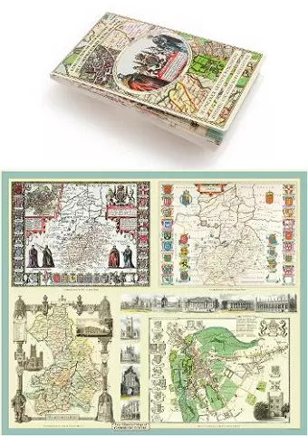
Cambridgeshire 1611 - 1836 - Fold Up Map that includes Four Historic Maps of Cambridgeshire, John Speed's County Map of 1611, Johan Blaeu's County Map of 1648, Thomas Moule's County Map of 1836 and Thomas Moule's Plan of Cambridge City 1836
Mapseeker Publishing Ltd author
Format:Sheet map, folded
Publisher:Historical Images Ltd
Published:15th May '13
Should be back in stock very soon

This non-fiction sheet map, folded, "Cambridgeshire 1611 - 1836 - Fold Up Map that includes Four Historic Maps of Cambridgeshire, John Speed's County Map of 1611, Johan Blaeu's County Map of 1648, Thomas Moule's County Map of 1836 and Thomas Moule's Plan of Cambridge City 1836" from Mapseeker Publishing Ltd, was published 15th May 2013 by Historical Images Ltd.
ISBN: 9781844918157
Dimensions: 237mm x 134mm x 8mm
Weight: unknown
1 pages