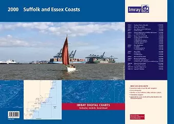
2000 Suffolk and Essex Chart Pack
Lowestoft to River Crouch
Format:Paperback
Publisher:Imray, Laurie, Norie & Wilson Ltd
Published:31st Oct '22
Should be back in stock very soon

This chart pack offers 10 updated navigational charts for the Suffolk and Essex coasts, including critical depth and wind farm data.
The 2000 Suffolk and Essex Chart Pack provides a comprehensive set of 10 navigational charts specifically designed for the Suffolk and Essex coasts. This latest edition incorporates updated depth surveys and relevant wind farm information, ensuring that mariners have access to the most current data. Each chart is meticulously crafted to facilitate safe navigation in these coastal waters, making it an essential resource for both seasoned sailors and newcomers alike.
Included in the 2000 Suffolk and Essex Chart Pack are detailed representations of various waterways and harbors. The charts cover a range of areas, such as the River Deben, Orford Haven, and the approaches to Harwich and Walton Backwaters. Each chart is presented at a scale that allows for easy interpretation, with specific plans for marinas and yacht harbors like Woodbridge and Titchmarsh. This attention to detail ensures that users can navigate with confidence in both familiar and less-traveled waters.
The 2018 edition of the pack features a wirobound design for durability and ease of use. Tidal stream information has also been included to assist in planning voyages. Notably, individual sheets of the atlas will no longer be available for separate purchase, though replicas of selected charts will be published. Overall, the 2000 Suffolk and Essex Chart Pack is an invaluable tool for anyone navigating these picturesque yet challenging coastal regions.
ISBN: 9781786794215
Dimensions: unknown
Weight: unknown
10 pages
New edition