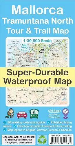
Mallorca - Tramuntana North Tour & Trail Map
Format:Sheet map, folded
Publisher:Discovery Walking Guides Ltd
Published:6th Mar '25
Should be back in stock very soon

For your best adventures, use the best map. Water-proof, split-proof, tear-proof, adventure-proof. Mallorca's Tramuntana North Tour & Trail Super-Durable Map is simply the toughest, most accurate, easy-to-read, easy-to-use multi-purpose map that you can get. Whether you plan to walk, or explore northern Tramuntana by car or the bus, this is the map for you. A large 960mm by 694mm double sided map sheet covers northern half of Serra de Tramuntana at 1:30,000 scale. This 8th edition sees a significant upgrade from the previous Mallorca North & Mountains Tour & Trail Map, as we have split Serra de Tramuntana in two halves to produce TWO much more detailed maps of larger scale.
This map covers a continuous area from Tramuntana's northern-most Cap de Formentor, including all the coastal resorts such as Port de Pollenca and Port d'Alcudia, all the way to Soller and Deia at the opposite end of the map (for the area from Soller further due south-west to Magaluf, Peguera and Port d'Andratx, see our second title: Mallorca - Tramuntana South Tour & Trail Map). Our new guide to Mallorca's public transport will help you get oriented in various service providers that operate buses, trains, metro and tram to make the most of your adventures. Bus stops along with actual bus numbers are then highlighted in the map to help you see where each bus runs. Those relying on a hire car will appreciate kilometre markers plotted each kilometre in the map on most roads, aiding you track progress and show where you are.
For walkers, the GR 221 long-distance route is specially highlighted in the map (red), with a boxed mini-guide to the GR 221 and GR 222, summarizing the most important aspects of the main route, its variants and accommodation. Highlighted in the map (green) are also published walking routes by Sunflower and Rother, helping you identify passable walking adventures on an island where private properties along trails may sometimes pose a challenge to hikers. We have also included a small dictionary or frequently used Catalan words appearing in the map. Our legendary 'Tour & Trail' level of detail ranges from railways, motorways, main roads, secondary roads, minor roads, streets and narrow country lanes, dirt tracks to walking trails and faint/difficult...
ISBN: 9781782750895
Dimensions: 232mm x 120mm x 7mm
Weight: unknown
2 pages
8th edition