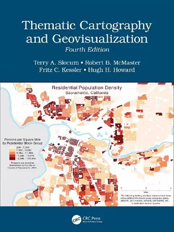
Thematic Cartography and Geovisualization
Robert B McMaster author Terry A Slocum author Fritz C Kessler author HughH Howard author
Format:Hardback
Publisher:Taylor & Francis Ltd
Published:18th Aug '22
Currently unavailable, and unfortunately no date known when it will be back
This hardback is available in another edition too:
- Paperback£52.99(9781032766676)

This comprehensive and well-established cartography textbook covers the theory and the practical applications of map design and the appropriate use of map elements. It explains the basic methods for visualizing and analyzing spatial data and introduces the latest cutting-edge data visualization techniques. The fourth edition responds to the extensive developments in cartography and GIS in the last decade, including the continued evolution of the Internet and Web 2.0; the need to analyze and visualize large data sets (commonly referred to as Big Data); the changes in computer hardware (e.g., the evolution of hardware for virtual environments and augmented reality); and novel applications of technology.
Key Features of the Fourth Edition:
- Includes more than 400 color illustrations and it is available in both print and eBook formats.
- A new chapter on Geovisual Analytics and individual chapters have now been dedicated to Map Elements, Typography, Proportional Symbol Mapping, Dot Mapping, Cartograms, and Flow Mapping.
- Extensive revisions have been made to the chapters on Principles of Color, Dasymetric Mapping, Visualizing Terrain, Map Animation, Visualizing Uncertainty, and Virtual Environments/Augmented Reality.
- All chapters include Learning Objectives and Study Questions.
- Provides more than 250 web links to online content, over 730 references to scholarly materials, and additional 540 references available for Further Reading.
There is ample material for either a one or two-semester course in thematic cartography and geovisualization. This textbook provides undergraduate and graduate students in geoscience, geography, and environmental sciences with the most valuable up-to-date learning resource available in the cartographic field. It is a great resource for professionals and experts using GIS and Cartography and for organizations and policy makers involved in mapping projects.
Interest in professional cartography has decreased since the 1980s at the expense of newer and emergent geographic information systems (GIS) software and related technologies. However, the fourth edition of this classic cartography textbook features significant additions made since its previous edition (2009) and reclaims geographic analysis as the realm of digital cartography. This text is admirably comprehensive in describing the development of the field of modern cartography from the 1950s to the present and surprisingly current in its engagement with the latest research. The text is organized into three main parts covering, respectively, principles, techniques, and geovisualization. The principles section covers foundational cartographic topics, including symbolization, classification, map projections, and map production. The techniques section covers choropleth maps and more advanced approaches, including highly informative chapters on intelligent dasymetric mapping (IDM) and multivariate mapping. The geovisualization chapters (part 3) include the most significant additions, including details of geovisual data analytics, map animation, and virtual environments. This edition clearly conveys the relevance of digital cartography to the emerging field of data science and will continue to be a required resource for academic programs offering the GIS specialization. This latest version is a teaching resource for undergraduates, graduate students, and professionals offering entrée to the classic and latest cartographic innovations.
C. A. Badurek, SUNY Cortland
Overall, to my mind, this impressive book stands far above any other cartographic textbook available. I recommend it as required reading for every GIS/cartographic program across academia… and will remain a rich and relevant resource of cartographic and geovisualization knowledge for some years to come.
Daniel G. Cole, Smithsonian Institution, published in Cartographic Perspectives #103, 2024 (full review https://cartographicperspectives.org/index.php/journal/article/view/1919/2283)
Slocum, McMaster, Kessler, and Howard have done an excellent job in both updating the previous edition and adding new material. This is a first-class textbook that I recommend without reservation. Thematic cartography and visualization are, in my view, increasingly important topics. The basic elements of cartography remain central, but students must be exposed to the latest cutting-edge visualization techniques, which this volume does very well.
Fraser Taylor, Carleton University, published in Cartographica, Vol. 59, No. 2, 2024 (full review https://www.utpjournals.press/doi/full/10.3138/cart-2024-0011)
The long-awaited update of this book is welcomed. It provides a good overview of many developments in recent cartographic research in a manner that is accessible to upper-level undergraduate students or (post-)graduate students. Its breadth might mean that students need to purchase only one book for multiple courses. For those cartographic practitioners who may have come to the discipline from another industry and who are looking to increase their technical knowledge, this is also a fine reference that introduces the scholarship that sits behind many mapping techniques.
Amy L. Griffin, School of Science, RMIT University, Melbourne, Australia – Published in the International Journal of Cartography, 05 Nov 2024 (full review: https://www.tandfonline.com/doi/full/10.1080/23729333.2024.2423320)
ISBN: 9780367712709
Dimensions: unknown
Weight: 2560g
584 pages
4th edition